Gardens1550 Albemarle Rdfree
Flatbush CommUNITY Garden
A block of Albemarle given back to whoever shows up with a trowel.
✓ seed v0 · verify it's still running
Parks, free workouts, playgrounds, piers, mailboxes, shipping counters. No ads, no ranking games — just what's there, with its source.
A block of Albemarle given back to whoever shows up with a trowel.
Sundays 8 to 2, all year, since 2003 — the one reliable weekly ritual in the zip. SNAP and Health Bucks: two dollars of EBT buys two more, up to ten a day.
The neighbours started asking in 1969 and got the doors open in 1983 — one of only two BPL branches inside 11226.
On Linden Blvd since 1905 — the sixth Brooklyn library Carnegie money built. Free, warm, and open to everybody.
The Caribbean vendors' market Una Clarke won for them in 2000, rebuilt under 255 affordable apartments and reopened in 2022. Around thirty stalls plus a food hall — it was the Flatbush Caton Market until the rebrand.
Brooklyn's last upland forest and its only lake — 250 acres of natural areas, 250-odd bird species a year, three waterfalls down the Ravine into the Lullwater. It is across the street from 11226, not in it: the zip stops at Parkside and Caton.
Forty acres of ball: baseball, soccer, football, netball, cricket, tennis, pétanque. Restored in 2004, open 6am to 10pm, permit only if you're twenty-strong. Technically 11218 — you cross the line to get here.
What's on the walls and in the halls — street art, landmarks, movie scenes, the museums and stages of the ledger — and the zips this one is twinned with, by decree and by geometry.
The 1787 clapboard schoolhouse, now marooned inside a Collegiate Gothic quadrangle. First secondary school chartered by the Regents; Hamilton, Burr and John Jay were on the subscription list. It sits in an active school campus — the courtyard is not a walk-in.
The congregation dates to 1654; this fieldstone Federal church went up 1793–98, the third on the spot. The churchyard holds the founding families — the oldest legible stone reads 1754 — and the windows are Tiffany.
1875, High Victorian Gothic, polychrome brick and a corner tower — built two years after Flatbush voted down annexation to Brooklyn. A monument to a town that wanted to stay a town. It lost that argument in 1894.
When the Brighton line was dropped into an open cut in 1907, they roofed the sides with shops — the oldest purpose-built outdoor shopping plaza in America, and still ten thousand people a day. Leon's has been cutting hair up there for about a century.
Dean Alvord bought fifty-odd acres of farmland in 1899 and sold the idea of a rural park inside the city — English street names, planted malls, brick gateposts. John Petit drew 44 houses here and repeated none of them.
Eleanor Roosevelt opened it on 5 November 1932, mid-Depression: three floors and a 103-foot Art Deco tower. It was the last Sears in New York City when it went dark in 2021, after 89 years. Landmarked, vacant, and mid-rebuild into housing.
131 Buckingham Rd, built on spec in 1902–03 — a Queen Anne wearing Japanese ornament. Three artisans came over for it: Saburo Arai built, Shunso Ishikawa coloured, Chogoro Sugai laid the garden. Still the most photographed house in Victorian Flatbush, still someone's home.
Nostrand Ave carries a second name between Newkirk and Flatbush Aves, hung there by the 2018 Little Haiti designation. Read the sign, then read the ledger of bakeries under it.
HBO kept coming back to the E 18th St houses and a Queen Anne on Rugby Rd — Atlantic City 1920 was cheaper to build in Flatbush than in Atlantic City. Ditmas Park has a house on Wellington Court that has hosted over a hundred shoots.
The same film shot inside the Kings, then abandoned, its plaster falling into the seats. The scene never made the edit. Two locations in one movie, four blocks apart; only one of them made it to the screen.
101 Rugby Rd — the 1903 Colonel Bacon house, painted bright pink for the 1982 film to match the novel's Pink Palace, and repainted a quiet grey the moment the crew left. It's Prospect Park South, whatever the internet tells you about Ditmas Park.
Monk parakeets from Argentina, building stick castles in the light poles. Everyone tells you a crate broke open at JFK around 1968; nobody has ever produced a witness. They are not really a Flatbush bird — the colonies are Brooklyn College and Green-Wood — but they're worth the walk.
Tokyo first (1960), then Beijing, Cairo, Madrid, Santo Domingo, Budapest, Rome, Jerusalem, London and Johannesburg — the city's jumelage ledger. Flatbush keeps its own unofficial twinning on Nostrand Ave, where the flags are Haitian, Trini and Jamaican.
The zip's antipode is empty ocean — the point falls in the Indian Ocean southwest of Australia, a thousand kilometres from any door. The nearest is Augusta, the small town on Cape Leeuwin where the Indian and Southern Oceans officially meet: one lighthouse, one bakery, and the whole of Antarctica next stop south.
Same parallel, longitude flipped across Greenwich — and the point lands in the foothills of the Fergana valley's rim in southern Kyrgyzstan. The nearest town is Özgön, a Silk Road stop with an 11th-century Karakhanid minaret and mausoleums of carved terracotta. New York's cast iron and Karakhanid brickwork share a latitude almost to the block.
Latitude mirrored below the equator: the point sits in the Pacific about thirty kilometres off the Chilean coast. The nearest door is Bahía Mansa, a fishing cove in San Juan de la Costa — larch forests down to the water, sea lions on the rocks, and the same cold-current fog that never reaches New York.
The zip's other residents — the animals, plants and corals you can actually meet here, with where to find them and when they show up.
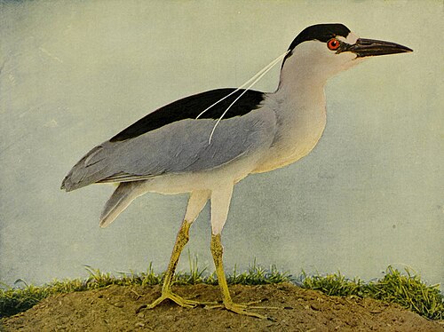
Hunched, red-eyed, motionless on a Lullwater branch until it very much isn't. Records peak hard from April to July and fall to nothing by November.
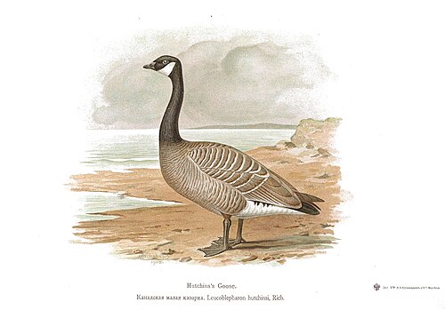
The single most-recorded species in the whole 11226 box — 189 research-grade sightings. Not glamorous. Numerically, the icon.
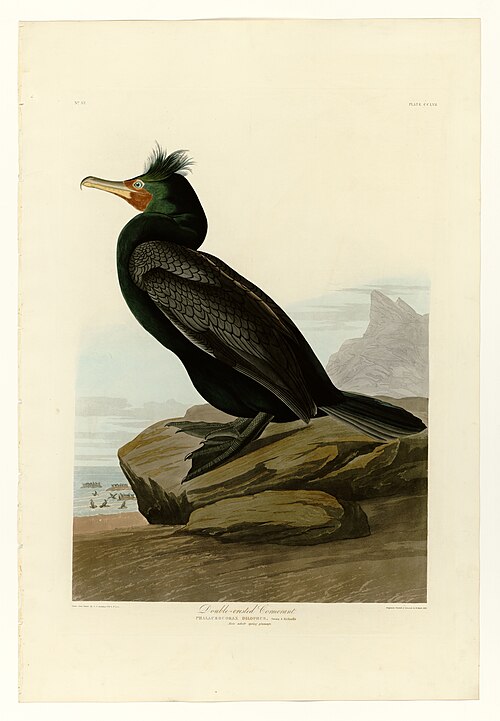
Stands on the Lake's dead snags with its wings held open — its feathers aren't fully waterproof, which is why it always looks like it's posing for something.
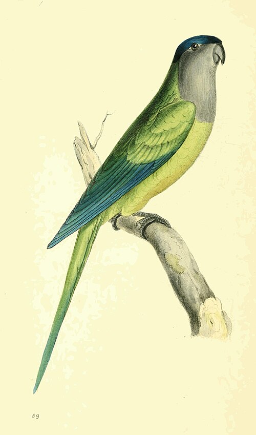
Argentine parrots building stick castles in floodlights. The JFK crate story from around 1968 is repeated everywhere and witnessed nowhere. Two records in all of Prospect Park, none in Flatbush — the colonies are at Brooklyn College and Green-Wood.
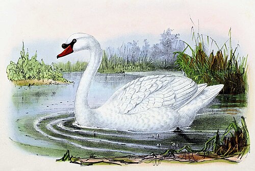
Third-most-observed bird in the box, at 129 records. Beautiful, invasive, and genuinely willing to come at you in nesting season.
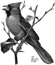
The one bird that reads as red against February snow on Argyle Rd. Sings from the hedges all winter, when nothing else is bothering.
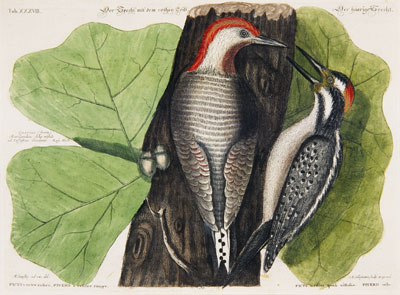
329 records in the park and exactly zero in the zip proper — one of the sharpest here/there splits in the ledger. Named for a belly blush you will never see; the red part is the head.
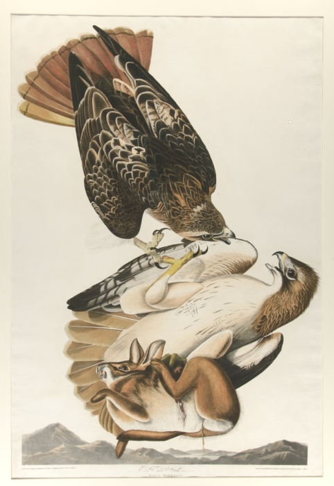
The one big animal that is genuinely 11226's own — nine records inside the zip proper, forty-one in the wider box, three nests in the park's tallest trees. Look up from Cortelyou Rd; there is usually something looking back.
The most-recorded fungus in the box. Fans out in lacquered red-brown brackets at the foot of a stressed street tree — beautiful, and a notice that the tree is being eaten from the base up.
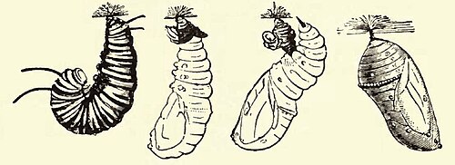
Only eleven records, and the calendar is blunt about it: the peak is August, not July. The southbound migration is a late-summer story here, not a midsummer one.
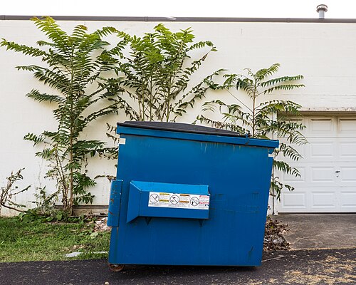
86 records — the most-observed insect in 11226, ahead of every bee and butterfly. The defining street-ecology fact of Flatbush right now: a genuinely gorgeous invasive that the city asks you to step on. It follows the tree of heaven.
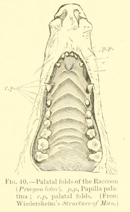
Seven records inside the zip proper — these are on your block, not just in the park. Victorian Flatbush's detached houses and porch crawlspaces are close to ideal denning.
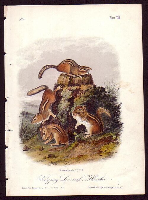
Prospect Park holds the only chipmunk population left in Brooklyn. Cross Parkside Ave and you're in the borough's last refuge; the Flatbush side has essentially none.
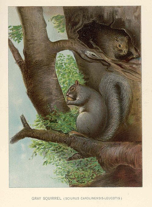
The default Brooklyn mammal, and it owns every pin oak on Rugby Rd. Circle a trunk and watch one flatten itself and rotate to keep the wood between you.
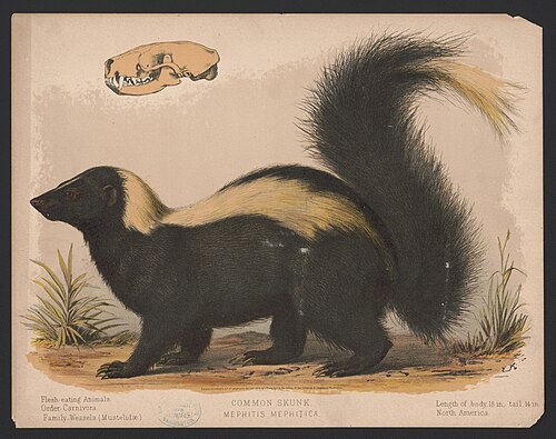
Exactly one research-grade record in the whole park, dated 2019. This is an is-it-back story, not a resident. You will not see it. Someone did.
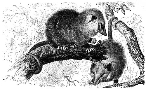
North America's only marsupial, playing dead on a Brooklyn sidewalk. Nine park records and zero inside the zip.
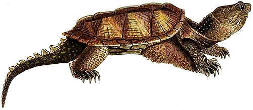
78 park records. New York's state reptile, up to eighteen inches and forty-five pounds. The April–June spike is females hauling out and crossing paths inland to lay. Give it the whole path.
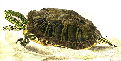
The most-recorded reptile in the box, and every last one is a dumped pet or the child of one — the native range is the Mississippi Delta. Dozens more get released each year. Snappers are one of the few things that out-compete them.
Planted 1872, five years after the park opened — a grafted weeping cultivar off the Earl of Camperdown's estate near Dundee. It was nearly taken out in the 1960s until Marianne Moore wrote it a poem in 1967 and helped found the Friends of Prospect Park to save it. A tree that survived on literature.
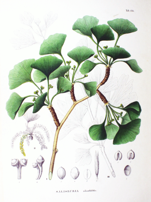
106 in the zip. Two hundred million years old as a lineage, and every November the female trees drop fruit that smells like something died on Marlborough Rd. Worth it for one gold week.
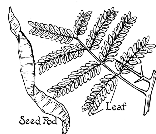
509 of them — not the London plane — make this the most common street tree in the zip, by half again. That fine, dappled, moving shade over Rugby, Argyle and Marlborough is the signature of Victorian Flatbush, and almost nobody can name it.
327 on the streets here. The camouflage bark and the fist-sized fruit balls — the tree New York planted everywhere because it will survive anything the city does to it.
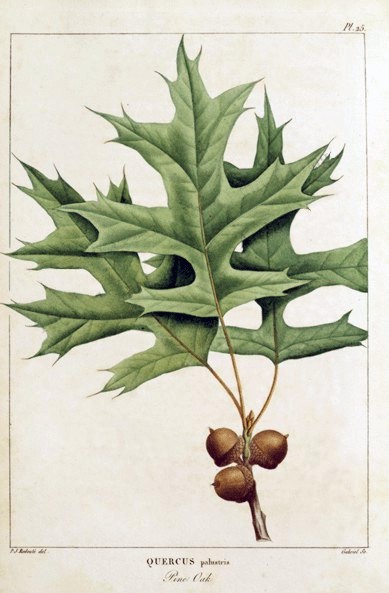
324 of them, and the squirrels' entire economy. Lower branches sweep down instead of up, which is how you know it in winter.
Every way in, out and across the zip — the trains and where they're headed, the buses, the bike docks, a cab when you need one, and what to do with a car.
On the private right-of-way cut for Prospect Park South — the developer's own station.
The station spells it Beverly; the street spells it Beverley. Nobody has fixed this.
Church & Nostrand. Elevators both sides since 1999 — the accessible one. Near two million rides a year.
The express stop. B is weekdays only and short-turns at 145 St outside rush hours.
Cortelyou between Marlborough Rd and E 16 St — the strip's own stop.
The Junction, and the end of the line. The only dead-end terminal in the system without an island platform — U-shaped side platforms, so know your track before you walk down. Just outside the zip.
Renamed 15 November 2021 and rededicated on the 18th — the 203rd anniversary of Vertières, the last battle of the Haitian Revolution. The date was the whole point.
The other express stop — platforms in the open cut, shops on the deck above.
Parkside & Ocean, right on the zip's northern edge — the park side of the line.
The limited — Canarsie to Downtown Brooklyn by way of Church, Coney Island Ave, Cortelyou and the Junction.
The northern edge — Lefferts Gardens across to East New York.
Along the park's southern wall — Bay Ridge to Prospect Lefferts Gardens.
The crosstown. Brownsville all the way to Sunset Park, straight across the zip's waist.
The spine. Downtown Brooklyn to Kings Plaza, one of the busiest routes in the borough — and currently crawling at about 4 mph. Church Ave and Flatbush Ave are both slated for bus rapid transit by 2030.
Nostrand down, New York Ave back up for the local; the SBS keeps to Bedford and Rogers. Williamsburg Bridge to Sheepshead Bay.
Bedford up, Rogers down, Ocean Ave through the middle — Crown Heights to Manhattan Beach.
Thirty docks at the busiest corner in Little Caribbean.
Greenmarket dock. Sunday mornings it is empty by nine.
Thirty stations and about seven hundred docks inside the zip since the 2023 buildout. This one has the best address in Brooklyn.
The dock you take to the Parade Ground when you're carrying cleats.
The block from below and at the corner — the traffic signals that time the street, and the manholes, drains and subway mouths that open onto everything running beneath it. Counted from OpenStreetMap; the parts no city publishes are named, not guessed.
Count is OpenStreetMap-derived — it maps each signalized crossing separately, so approaches are clustered into intersections (≈, not exact). The timing isn't public at all: per-signal cycle plans aren't published. Most run fixed, coordinated cycles you can learn by standing at the corner; some busier crossings are sensor-actuated or adaptive to live traffic — where a city states which, it's tagged above; where it won't, it reads Not published.
The surface access is mapped — manholes, storm drains, subway mouths and vents. What they open onto isn't: the water, sewer, gas and cable networks that run below the block are not public geometry, so they're named here, never drawn as fake lines. Points from OpenStreetMap.
Every café, restaurant, bar and counter on the ledger — typed and faceted straight from the knowledge layer.
The zip's flagships, staples and indies, the brands they carry, and the shared product vocabulary underneath — the graph an integrated zip-POS would settle against. 0 retailers · 0 brands tracked.
The block's human makeup — the cohorts, the day-vs-night swell, the mix of who shows up. Set a lens up top and you'll see yourself among the neighbours.
About 0 more people are here by day than sleep here.
Every seat that holds power over the block, from the community board to the president. The template ships the seats; each edition fills the names from a dated source — an open seat means not yet sourced, never guessed.
The police surveillance technology documented over this block — plate readers, cameras, drones, face recognition and the rooms that pool them. Counted from the Atlas of Surveillance; a category with none documented is marked as such, never guessed, because absence of a record is not proof a tool isn't in use.
Software that matches faces from cameras or photos against a database to put a name to a person — often without their knowledge or consent.
Cameras that photograph every passing plate and log where and when it was seen, building a searchable map of a car's movements over months or years.
“Stingray” devices that impersonate a cell tower so nearby phones connect to them, revealing the location and identity of every handset in range.
Algorithms that forecast where crime will happen or who is likely to be involved, directing patrols and scrutiny toward people and blocks by statistics.
Unmanned aircraft used for aerial surveillance, crowd monitoring and, increasingly, as first responders dispatched to calls with cameras rolling.
Networks of always-on microphones on streetlights and buildings that listen for gunfire — and can capture voices — then send police to the sound.
AI layered onto camera feeds to automatically flag people, objects or behaviour, and to search hours of footage for a shirt colour, a bag, a face.
A roster of private security cameras — doorbells, shops, homes — that residents register or connect, letting police pull footage from across the block.
Cameras worn by officers. A record of encounters that can protect the public — but also a mobile, searchable feed whose footage the department controls.
Commercial services that pool phone, location, social-media and public records into one search, letting police buy access to data they'd need a warrant to collect.
A control room fusing live camera, plate, gunshot and phone feeds onto one wall — the hub that turns scattered sensors into continuous watching.
A state or regional office where local, state and federal agencies share intelligence — pooling records on people across jurisdictions with little public oversight.